Before finalising the outline application, Ashberry Strategic Land would like to engage with the local community and seek your views and suggestions. You can send us your comments via the online comments form at the end of this website.
Ashberry Strategic Land is a land promoter and is owned by the experienced national house builder Bellway Homes Ltd. Both organisations have a history of delivering high quality residential developments across the UK.
Ashberry understands that residents will be keen to understand the proposals in more detail. This website and its content have been designed with that in mind and aim to explain the nature of the proposals and their unique benefits in providing a comprehensive response to meeting the housing of the village and wider District into the future.
This public consultation event sets out our initial design proposals as well as the technical and environmental considerations which have informed the proposed design. We are keen to engage with the local community and all other stakeholder parties before finalising our proposals.
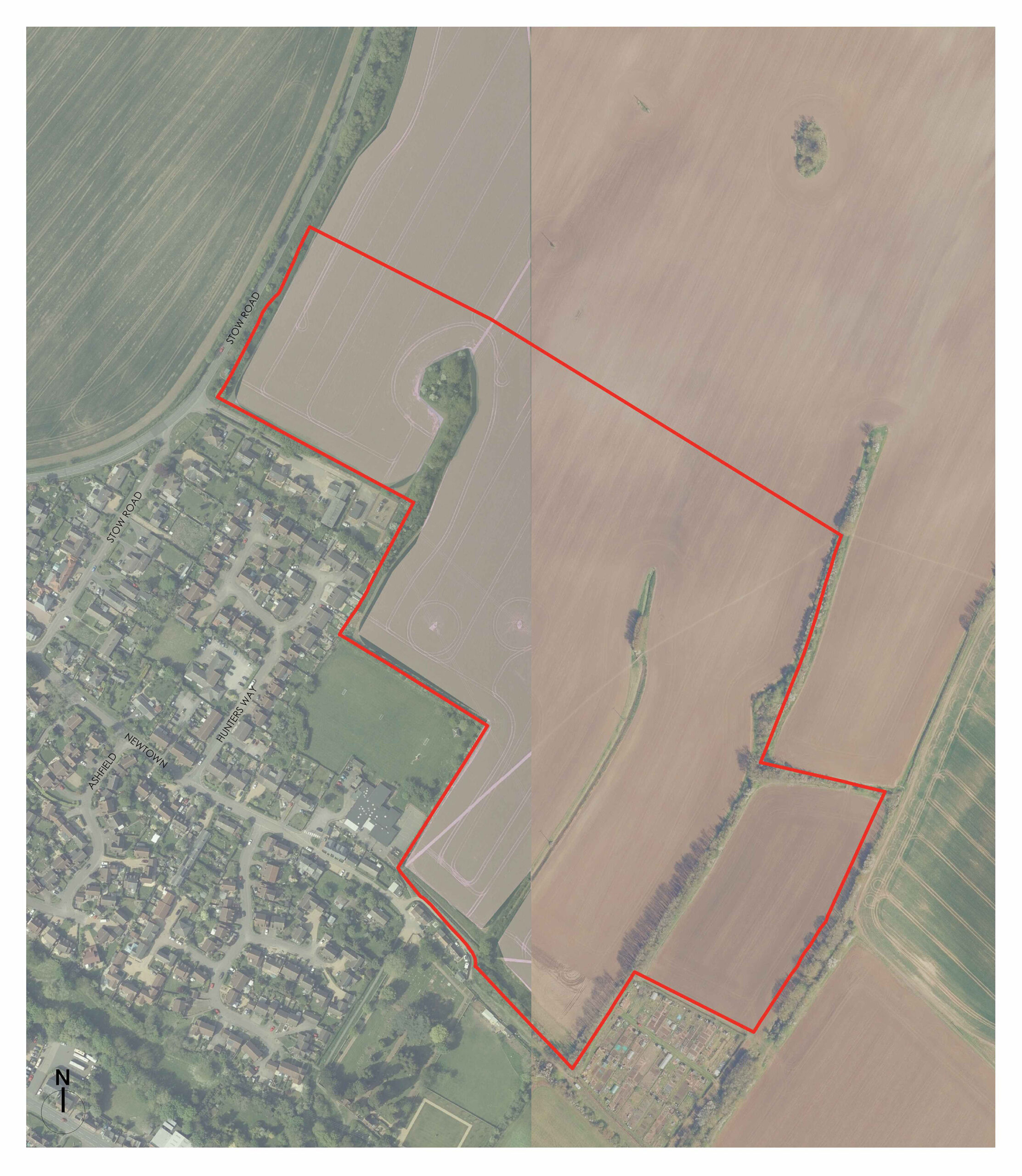
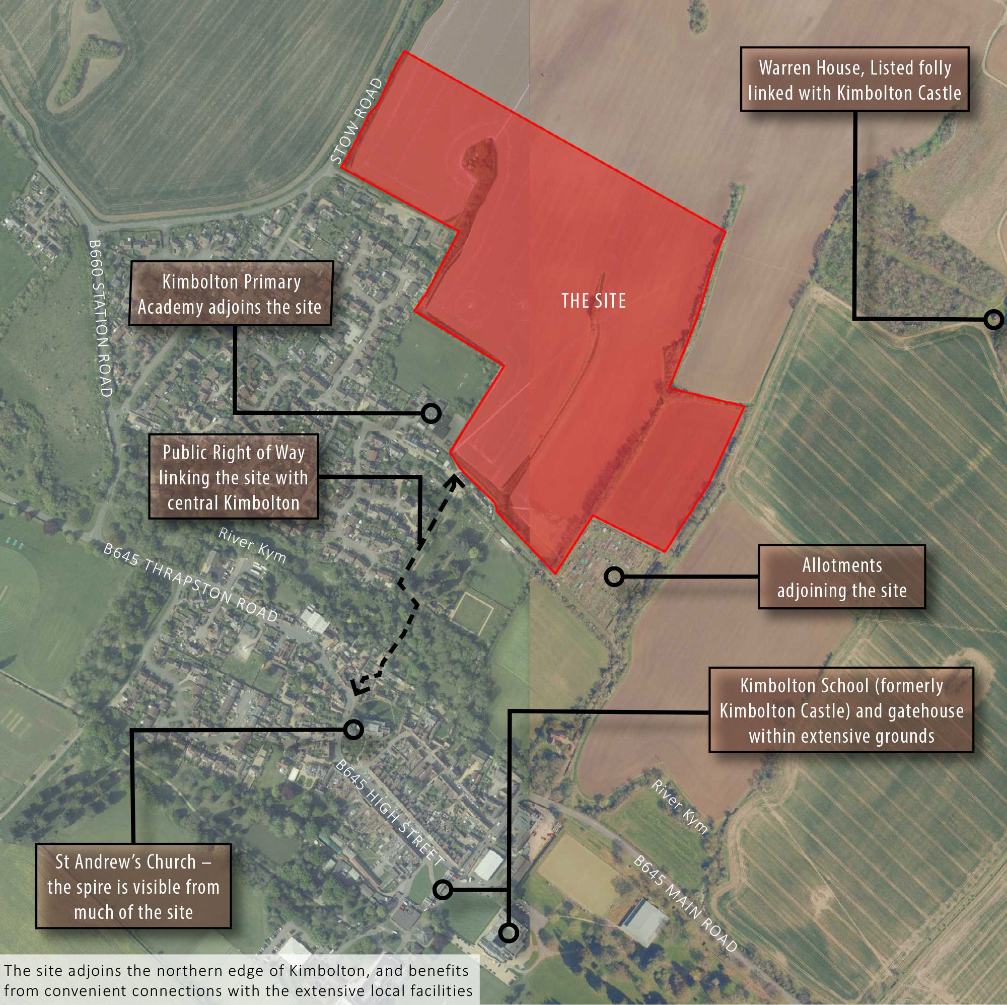
The Site itself comprises 17.18 ha of Grade 2 agricultural land on the northern side of Kimbolton, adjacent to the residential edge of the town.
The topography of the Site comprises a fall from north to south, with a relatedly steep gradient in the upper half of the site. To date in the promotion of the Site, this has been taken into consideration with the locating of homes at the southern end of the Site on lower ground, adjacent to existing residential development and the provision of extensive green infrastructure in the northern part of the Site.
The Site itself is not in the Conservation Area but to the northeast, set above the village is a Grade II* listed folly. This is known as Warren Lodge and was originally built as a warrener’s lodge for the gamekeeper for the rabbits.
In the 18th century, it was incorporated into a scheme of parkland improvements for the Duke of Manchester as part of a wider parkland design and the timber façade was added to with the addition of stone and brickwork. However, despite this, the relationship between the Lodge and Kimbolton Castle to the south has become an important consideration for any planning application.
The Site is located within Flood Zone 1 but there is the potential for surface water flooding in the proximity of the Stow Road boundary. There are no nature conservation designations on the site but there are a number of Public Rights of Way which cross the site which will need to be addressed as part of any development proposals.
The site is located in a sustainable location close to local facilities and services in Kimbolton which are easily accessible by walking and cycling including being less than 200m walking distance from Kimbolton Primary School.